29.3.06

Caver dies in rock fall at Pikehall

AN experienced caver died in a rockfall while excavating new passages to explore underground.
David Briggs' two colleagues rushed to get help after a section of cave collapsed at Aston Hill Farm near Pikehall on Saturday morning – launching a desperate rescue operation.It is thought to be the first caving death in Derbyshire for about 15 years.A spokesperson for the Derbyshire Cave Rescue Organisation (DCRO) said: "People go caving every week and the vast majority do so very safely."But like anything else, like driving your car, things occasionally, tragically, go wrong."The three-man caving party were said to be "swallet holing" – a practice of digging to extend cave networks. They had been working on the site, near to the Via Gellia Road, for a number of weeks. (...)

Full article: Bbakewelltoday.co.uk


"A exploração da Gruta do Centenário, hoje com - 454 m, ensinou-nos mais uma vez que uma das poucas coisas previsíveis a respeito de cavernas é que elas são imprevisíveis."

SBE nº 9 Noticias - Boletim electrónico da SBE

28.3.06

Bernard Gèze (1913-1996)


24 Março 1913, Toulouse - 8 Dezembro 1996

Autor de "La Spéléologie scientifique", Bernard Gèze publicou
diversos artigos em revistas de geologia, espeleologia.

2° Congrès international de Plongée Souterraine

27.3.06

Bears and humans in Chauvet Cave (Vallon-Pont-d’Arc, Ardèche, France)

Bears and humans in Chauvet Cave (Vallon-Pont-d’Arc, Ardèche, France): insights from stable isotopes and radiocarbon dating of bone collagen
H. Bocherens, D. G. Drucker, D. Billiou, J.M. Geneste, J. van der Plicht


"Chauvet Cave has yielded the oldest parietal art, dated to ca. 32,000 years BP (Clottes et al., 1995; Valladas et al., 2001, 2005), in an exquisitely preserved archaeological context. Thousands of animal skeletal remains have been found on the cave floor, mostly from cave bear (Ursus spelaeus), representing at least 190 individuals (Philippe and Fosse, 2003). Moreover, archaeological remains have been identified on the floor in Chauvet Cave, such as animal and human footprints, combustion structures, a few flint artifacts, and an ivory spearhead (Garcia, 2005; Geneste, 2005). Understanding the relationship between cave bears and humans in Chauvet Cave is a key question. Indeed, the question of a special relationship between cave bears and humans, such as hunting or worshiping, is still a debated issue (e.g., Garcia and Morel, 1995; Pacher, 2000; Mu¨nzel et al., 2001). Evidence for interactions between humans and bears in Chauvet Cave include displaced bones, such as the famous skull on the block in ‘‘Salle du Crâne’’ (skull chamber), and scratch marks from bear claws superimposed on some paintings, but it is not yet clear whether human action was involved in the location and selection of some skeletal elements on the cave floor (Philippe and Fosse, 2003). Chauvet Cave is a unique case where modern biogeochemical techniques, especially stable isotope analysis and radiocarbon dating of residual collagen, can be used on the fossil bones (e.g., Bocherens et al., 1994; van der Plicht et al., 2000). Radiocarbon dates presented here fit the bears within the chronological framework established on the basis of dates already obtained on paintings, charcoals in hearths, and speleothems. Stable isotopic results allow us to document possible changes in bear diet and habitat according
to spatial and chronological parameters. Altogether, these new results give us some insight into the relationship between humans and bears in Chauvet Cave."

Journal of Human Evolution Volume 50, Issue 3 , March 2006, Pages 370-376

Article available online: Here


De la faune au bestiaire – La grotte Chauvet–Pont-d’Arc, aux origines de l’art pariétal paléolithique - Paléontologie humaine et Préhistoire

V. Feruglio

"Les datations absolues et les études pluridisciplinaires menées depuis sept ans à la grotte Chauvet–Pont-d’Arc révèlent un art pariétal européen des origines, remontant à la première culture du Paléolithique supérieur : l’Aurignacien. Un changement climatique pourrait-il en avoir favorisé l’émergence ? Aurait-il conduit de nouveaux groupes humains en des terres plus propices ? Plus largement, quel rôle l’environnement joue-t-il dans la création artistique des temps paléolithiques ? De ce qui nous est donné à voir dans l’art de Chauvet, nous tenterons d’en déduire le paléoenvironnement et les conditions qui ont présidé à son existence."
Comptes Rendus Palevol Article in Press, Corrected Proof
Pdf available: Here

Jules Vernes (1828-1905)


"Cést au moyen de ces simples cordes que le professeur Lidenbrock, son neveu et son guide vont s'enfoncer verticalement dans les profonders du globe... "


Decent verticale, pag. 169
In Voyage au centre de la Terre - Jules Verne


Júlio Verne (8 de Fevereiro 1828, Nantes - 24 de Março 1905, Amiens) escritor francês, um visionário, um autor antes do seu tempo.

Filho mais velho de um total de cinco filhos de Pierre Verne, advogado, e Sophie Verne.

Considerado o pai da ficção científica. Muito antes dos avanços científicos e tecnológicos o permitirem, já Júlio Verne falava sobre submarinos, máquinas voadoras, viagem à lua, etc..

Biografia: UNMuseum.org

24.3.06

Mayan underworld holds natural wonders


The ancient Maya once believed that Mexico’s jungle sinkholes, containing crystalline waters, were the gateway to the underworld and the lair of a surly rain god who had to be appeased with human sacrifices.
Now, the “cenotes,” deep sinkholes in limestone that have pools at the bottom, are yielding scientific discoveries — including possible lifesaving cancer treatments.
Divers are dipping into the cenotes, which stud the Yucatan peninsula, to explore a vast underground river system.

Hefting air tanks, guidelines and waterproof lamps, they have so far mapped 405 miles (650 kilometers) of channels that form part of a huge subterranean river delta flowing into the Caribbean Sea, and they are only just starting.
Scientists investigating the network of caverns and galleries, formed by rainwater passing through porous limestone, have found a wealth of early archaeological relics and prehistoric animal bones.
They also have identified dozens of new aquatic species specially adapted to extreme environmental conditions that could have medical applications. (...)

More than 500 sinkholes (...)

Blind fish and mammoth bones (...)

The hundreds of tourists who dive and snorkel each day in any of a dozen cenotes and caves open to the public are also unwittingly destroying the ecosystems before they can be properly understood, Iliffe says.

Full article: Msnbc.msn.com

the sepulchralpit of Sima de los Huesos, Sierra de Atapuerca, Burgos, Spain

The emergence of a symbolic behaviour: the sepulchralpit of Sima de los Huesos, Sierra de Atapuerca, Burgos, Spain

E. Carbonell, M. Mosquera

"Sima de los Huesos is one of the most complex Pleistocene sites at Sierra de Atapuerca (Burgos, Spain). This pit has yielded a number of 28 hominids dated around 400 kyr. This is the most complete collection of Middle Pleistocene Homo heidelbergensis around the world. Sima de los Huesos was never a hominid occupation place, since no traces of habitation has been discovered, nor a carnivores net, because there are not herbivores remains. However, it contains a large variety of carnivores, such as foxes, large felidae, wolfs, mustelids, and bears. The presence of these specimens may be explained as several events of natural falling, hibernation and catastrophic death, particularly clear for the bears’ case. This may be supported by the fact that all these specimens are present along the whole sedimentary sequence. On the contrary, human remains are mostly concentrated inside a quite discrete sedimentary level, which cannot be explained by any kind of catastrophic nor attritional event, according with the age’s profile. The recent finding of an Acheulean handaxe at the Sima de los Huesos cave site casts light on the evolution of human behaviour during the Middle Pleistocene. It is a finely flaked quartzite handaxe, which is associated with the hominid assemblage. The particular nature of the deposit involving its taphonomy, palaeontology, and technology points to a symbolic meaning both of the tool and the human accumulation. This would support the hypothesis of human mortuary practices performed at the Sima around 400 kyr ago. This discovery allows us to extend human complex behaviour and symbolism of mortuary rituals 300 kyr earlier than broadly heretofore accepted."
Comptes Rendus Palevol Article in Press, Corrected Proof
Pdf available: Here

23.3.06

Sinkhole-prone areas targeted for conservation

"But Weck, a biology professor and gentleman farmer, is concerned about the trouble housing developments have caused his sinkholes. Or, more precisely, the ecological damage from sewage runoff into sinkhole-fed underground streams.
St. Clair County is concerned, too. Hoping to lessen the impact of development, county leaders have targeted sinkhole-prone property for conservation.
Geologist Philip Moss of Waterloo said parts of St. Clair and Monroe counties have the highest concentration of sinkholes in Illinois, an average of about 75 holes per square mile. The holes lead to underground streams, creating unique wildlife habitats. They're often surrounded by a grove of trees and add a rolling quality to the land, attracting developers."It looks pretty," Moss said. "Farmers prefer selling it first because it can't be used very well for farming."But he and other experts say septic systems often don't control enough pollution, letting bacteria seep into the underground streams. That can contaminate wells, meaning some homebuilders will have to add costly water treatment systems.
The choice to protect property, however, will ultimately fall to landowners.
About 40 landowners, Weck included, have already received letters notifying them of tax breaks they can receive if they create conservation areas. Another 200 of the largest landowners, those who own more than 10 acres in the southwestern part of the county, are expected to get letters, too. Weck, who already has land in the program, is considering adding acreage under a state conservation program.Sinkholes in St. Clair and Monroe counties develop in areas known as "karst," a term for land formations of porous rock that have a significant amount of natural seepage. Of the two counties, Monroe has significantly more karst area than St. Clair." (...)
Full article: Stltoday.com

Long-term changes in the cave atmosphere

Long-term changes in the cave atmosphere air temperature as a result of periodic heliophysical processes

P. Stoeva, A. Stoev, and N. Kiskinova
"Climatic trends connected with short- and long-period variations of the solar activity occur as a reaction even in such conservative media as the air volumes of karst caves. The yearly mean air temperatures in the zone of constant temperatures of four show caves in Bulgaria were studied for a period of 36 years (1968–2003). The examination was made by everyday noon measurements in Ledenika, Saeva dupka, Snezhanka and Uhlovitsa cave. The caves are situated at different altitudes and geographic latitude. Seasonal fluctuations of the yearly mean air temperature in the ZCT of the explored caves have been identified by Fourier analysis. The same analysis has been applied for the Sunspot number and Apmax indices, which are representatives of the solar and geomagnetic activity, for the same period of data available. Autocorrelograms have been used for examination of the seasonal patterns of the air temperatures in the ZCT in every cave and in Sunspot number and Apmax indices. Cross-spectrum analysis has been applied for retrieving the correlations between air ZCT temperatures in the caves and solar and geomagnetic activity. It has been found that the correlation between ZCT temperature time series and sunspot number is better than that between the cave air temperature and Apmax indices. It has been found that is rather connected with the first peak in geomagnetic activity, which is associated with transient solar activity, i.e., coronal mass ejections (CMEs) than with the second one, which is higher and connected with the recurrent high speed streams from coronal holes (Webb, D.F., 2002. CMEs and the solar cycle variation in their geoeffectiveness.
In: Wilson, A. (Ed.), Proceedings of the SOHO 11 Symposium on From Solar Min to Max: Half a Solar Cycle with SOHO, 11–15 March 2002, Davos, Switzerland. ESA Publications Division, Noordwijk, 2002, ISBN 92-9092-818-2, pp. 409–419). This work can contribute to studying the mechanisms of atmospheric circulation changes and calibration of long-period climatic data read from cave speleothems and deposits. "Copyright © 2006 Elsevier Ltd All rights reserved.
Physics and Chemistry of the Earth, Parts A/B/C Article in Press, Corrected Proof
Full article:Here

22.3.06

Deciphering bone depositional sequences in caves

Deciphering bone depositional sequences in caves through the study of manganese coatings
F. López-González, A. Grandal-d'Anglade, and J. R. Vidal-Roman

"The presence of black-coloured bones in caves has been sometimes associated to the use of fire by humans, but more frequently the agent responsible for black colour is the natural deposition of manganese oxides. Manganese coatings were not usually studied once human action was discarded. However, they can provide valuable information about the origin and the sequence of formation of a palaeontological or archaeological deposit. In this paper, we present a quantitative and qualitative study of the manganese coatings that affect most of the bones recovered in the palaeontological site of Liñares cave (NW of Iberian Peninsula) together with other taphonomic marks. The manganese coatings are superimposed on other features previously existing on the surface of the bones. In turn, the coatings can be affected by other agents that modified them totally or partially. The combined interpretation of the different taphonomic marks provides us with valuable information on the sequence where the different taphonomic processes were produced, as for example the intervention of carnivores in the disarticulation of some elements before the burial, the preservation of anatomic connections until after the burial of the carcasses, and the existence of reworking processes in some parts of the infill. " (...)

Journal of Archaeological Science Volume 33, Issue 5 , May 2006, Pages 707-717

Full article: Here

Caves Vandalized


When Justin Epps crawled down into the Big Room about a month ago, he was dismayed at the site that greeted him and fellow caver Kyle Voyles.
The room, part of the complex that makes up the Bloomington Cave, was littered with beer cans and bottles and a bunch of kids hanging around and drinking.

Just a little over a year ago, a group of caving enthusiasts from nearby states traveled to the Bloomington Cave on weekends for an extensive cleanup operation - hauling out trash and removing graffiti from its fragile walls. "It was really frustrating," Epps said.


Voyles, the Arizona state cave coordinator who also works as a physical science technician with the Bureau of Land Management, called the recent vandalism disheartening.
"We are in the process of doing our management plan and the cave must be protected," Voyles said. "We will be gating the cave and require a permit. It's a free permit, but all of this is a direct correlation with the way people treat the cave."
The Bloomington Cave is unique because it is a tectonic cave and, by far, the largest cave in Southern Utah and northern Arizona. It is also the fourth-longest cave in Utah. (...)

Full article: Thespectrum.com

21.3.06

Cave rescuers: 'It was an amazing experience'

David Shipman has been released from the hospital following a 24-hour rescue effort Friday.
Shipman, age 20, disappeared after rappelling into a cave in the Huachuca Mountains. Two friends quickly called for help.
Nearly a dozen agencies throughout Southern Arizona assisted in the rescue sending in an estimated 170 people.
Among the rescuers, two paramedics from the Fry Fire Department in Sierra Vista. Captain Mike Palestro and Mike Short were two of the first people to make contact with the Duke University student.
Short said, "He could understand, but he would squeeze his hand for yes or no to get answers from him. That's how it was for the first couple of hours until he got rest and was able to talk to us."
Palestro said they made their way into the cave at 12:30 a.m. and emerged with the injured caver 16 hours later,
"He helped us because he realized that we couldn't do it without his help, especially in some parts, trying to get him back through the small hole he had fallen through," Palestro said.
Shipman was found lying in a 20 x 20 ft. cavity. Paramedics say he suffered from dehydration and hypothermia.
Palestro considers it a miracle that the caver did not suffer greater injury after falling an estimated 40-to=50 feet.
Lee Ryan, a member of the Southern Arizona Rescue Association, also assisted in the rescue.
"We probably, in the end, had over 100 people working on the site. The truth is, we needed every single one of them," Ryan said.
The rescue effort took a total of 24 hours.

GEOMORPHOLOGY OF KARST DEPRESSIONS

POLJE OR UVALA - A CASE STUDY OF LUÈKI DOL Acta Carsologica

EL IMPORTANTE POTENCIAL ESPELEOLOGICO DEL YUCATAN. MEXICO


La península de Yucatán es una gran losa calcárea de 175 000 km2 de superficie, que junto con la península de la Florida conforman los extremos del Golfo de México. Las costas de Yucatán está bañadas al norte y oeste por las aguas del Atlántico y al este por las del mar Caribe. Al sur, en donde se une al continente, limita con las montañas mayas de Belice y con el Arco de la Libertad en Guatemala.
Casi en su totalidad, Yucatán está constituida por rocas sedimentarias carbonatadas del periodo Terciario de la era Cenozoica, las cuales son propicias para el desarrollo de una serie de fenómenos que en su conjunto son conocidos como kársticos. Esta palabra, originaria del croata kras, fue utilizada en sus primeras acepciones para referirse a las rocas carbonatadas que han sufrido el ataque químico de las aguas meteóricas y de infiltración. Con este proceso lento pero continuo se forman las oquedades que dan al paisaje un toque singular y crean fisiografías particulares (cuevas, cenotes, valles ciegos, casimbas, petenes, etcétera).
La espeleología, término científico acuñado por Emile Riviere a finales del siglo XIX, hace referencia textualmente al “estudio o tratado de las cavernas”, y actualmente entendemos por espeleología el estudio de las cavidades naturales, de su génesis, de su desarrollo y además las formas de vida reciente o antigua que en ellas se han desarrollado o que todavía existen.
En su conjunto, la península de Yucatán representa 35% del karst de México, de ahí la importancia que tiene para el estudio de esta materia.


LAS ZONAS FISIOGRÁFICAS DE LA PENÍNSULA YUCATECA
Diferentes autores han propuesta dividir la península de Yucatán en las siguientes fisiografías:
1. La planicie kárstica del norte.
2. El distrito oriental de bloques afallados.
3. La sierrita de Ticul.
4. Las planicies y colinas kársticas del sur.

(...)

Full article: Cota Cero

CONTAMINACION EN RAJA SANTA. GRANADA, ESPAÑA

La Guardia Civil desciende al acuífero de Sierra Elvira para analizar si está contaminado.
Espeleólogos de dos clubes granadinos han detectado en el paraje de Raja Santa, en un terreno protegido de Sierra Elvira, una sustancia que parece ser aceite en un acuífero situado a unos 120 metros por debajo de la tierra.
Supuestamente, esta reserva de agua nutre los pozos de los que algunos municipios del Área Metropolitana toman su agua para el consumo humano.
Según explicó Sergio Iglesias, el pasado puente de la Constitución dos integrantes de los grupos de la Sociedad Grupo de Espeleólogos Granadinos y del Grupo Ilíberis, se desplazaron hasta la sima de Raja Santa para explorar la cueva con otros compañeros de un grupo mallorquín. Iglesias relató que comenzaron a bajar un grupo de cinco personas para que sus compañeros de Mallorca conocieran la sima, que es reconocida por sus características a nivel nacional.
Al llegar al final de la cueva, existe una laguna subterránea de aguas termales que "tradicionalmente cuenta con un agua transparente y cristalina". Los espeleólogos pudieron comprobar que sobre la superficie del agua se extendía una especie de pátina de color negro "y que tenía manchitas como de aceite".
En un primer momento, los excursionistas pensaron que esta capa podía ser cualquier material desprendido de la cueva, hipótesis que descartaron al bañarse uno de ellos en el lago "como es tradicional que se haga al llegar allí".
Al salir del agua, el cuerpo del espeleólogo quedó manchado de lo que en un primer momento identificaron como aceite o algún tipo de hidrocarburo del que tomaron muestras. No obstante, "hasta que no se le realicen análisis no podemos saber exactamente qué sustancia es", recalcó Iglesias, quien insistió en que en la cueva identificaron cierto olor a aceite.
Al comprobar la suciedad del agua, el grupo de espeleólogos consultó el libro que existe en la cueva, en el que los que la visitan suelen anotar algunas circunstancias sobre el nivel del agua, la temperatura y otras características del lago. En el libro en cuestión, encontraron varias anotaciones en las que otros excursionistas que habían visitado esta zona ya señalaban la suciedad que presentaba el agua, "por lo que la contaminación debe venir de largo", explicó el espeleólogo.
Granada Hoy se desplazó hasta el lugar a fotografiar la entrada de la gruta, en el término municipal de Atarfe. Allí, agentes del Servicio de Rescate en Montaña (Sereim) y del Servicio de Protección de la Naturaleza (Seprona) de la Guardia Civil se encontraban inspeccionando la sima en cuyo interior se encuentra el lago.
Según explicaron los agentes requeridos por este periódico, los espeleólogos denunciaron verbalmente durante la mañana de ayer la situación del acuífero. Con todo, Sergio Iglesias señaló que la intención de los dos clubes de espeleología es presentar una denuncia formal ante la Guardia Civil por la contaminación del lago.
Los agentes que se desplazaron hasta Sierra Elvira descendieron 120 metros por la gruta de Raja Santa a tomar muestras del agua del lago subterráneo para remitirlo a un laboratorio de Motril y al Instituto Nacional de Toxicología de Madrid, con el fin de que se identifique el producto que se ha encontrado sobre el agua de la sima y su grado de toxicidad.
Según explicó Iglesias, el acuífero en cuestión surte de agua a otros que se encuentran en la Vega y de los que algunos municipios del Área Metropolitana toman su agua, "por lo que se podría dar un problema de salud pública", en caso de confirmarse que la sustancia es aceite.
Según explicaron, junto a la sima se encuentran unas balsas de alperujo que se están sepultando bajo toneladas de tierra y que podrían ser la fuente de contaminación, ya que el terreno en el que se encuentran no impide la filtración al subsuelo. Estas balsas, que están tapando para poner en marcha un proyecto del Ayuntamiento de Atarfe, deberían haber sido vaciadas antes de sepultarlas, según precisaron, para evitar así las filtraciones.
También señaló que los vertidos de esponjas de coches impregnadas en aceites, que también se realizaron hace ahora un año sobre el acuífero, podrían ser los responsables de la contaminación del agua. La Guardia Civil está investigando este asunto. (...)

Full article: Cota Cero

Sandstone caves

Lindolfo cave, Paraná State (Brazil): Triassic-Jurassic aeolian sandstone cave situated in the third Paraná Plateau, near the city "Paulo Frontin", displaying curious phreatic-like tubes (Photo José Mário Budny)

20.3.06

Google Mars


Veja o novo Google Mars, parece ficção científica, mas não é.

É parte da superfície de Marte que foi cartografada pelas várias missões da NASA e da ESA.

Descubra as principais áreas de prospecçao de tubos e algares vulcânicos!

Duke student rescued from S. Arizona cave

A Duke University student from Sierra Vista who disappeared after rappelling into a cave on Fort Huachuca was rescued yesterday after about a 24-hour search.
David Shipman, 20, was taken by helicopter to University Medical Center in Tucson, Fort Huachuca spokeswoman Tanja Linton said.
UMC said Shipman was in serious condition and underwent tests last night.
Shipman, who was home from school on spring break, went hiking Thursday with two friends in a remote area of the Huachuca Mountains.
The cave is toward the fort's west gate, Linton said.
Shipman, an ROTC cadet, told his friends he was going to rappel into a cave on a sheer cliff for about a half-hour. When he failed to emerge 90 minutes later, one friend went for help.
About 170 law enforcement and rescue personnel from the fort, Cochise and Pima counties and from the U.S. Border Patrol were at the site through yesterday afternoon, when rescuers, including paramedics, brought Shipman out of the cave, Linton said.
The area is inaccessible by vehicles, and because of high winds, a Black Hawk helicopter from Davis-Monthan Air Force Base's 305th Air Rescue Squadron flew rescuers to the site. (...)

Article from: Tucsoncitizen.com

PseudoKarst Symposium

Call For Papers - PseudoKarst Symposium

Cavers:
Please submit your abstracts by May 1, 2006 for the Pseudokarst 2006 Symposium at the 2006 NSS Convention in Bellingham, Washington. The abstract should be 250 words or less and contain the authors complete contact address. Your current telephone number should also be included, but will not be published. Electronic submission as a MS Word or PDF file as an email attachment is preferred, but paper submissions to the following address will also be accepted.
Steve Stokowski
NSS #14425FE 508-881-6364
mail to: S. Stokowski
1058 Sodom Rd. Westport, Mass. 02790

16.3.06

Boletim Electrónico SBE nº 8

Fluorescência

Deve-se à presença de um musgo chamado Schistostega pennata, com propriedades bioluminescentes.
Um espectáculo deslumbrante, relembrando que entre a ficçao e a realidade há uma ténue fronteira...

15.3.06

Guardas com formação em espeleologia

Há uns anos um homem apostou que conseguia saltar por cima da boca do algar da Bajanca, no Parque Natural das Serras de Aire e Candeeiros (PNSAC), com um diâmetro de dois metros. O aventureiro caiu numa profundidade de 30 metros e morreu. Se fosse hoje a ocorrência podia ter sido investigada pelos dois únicos militares da GNR habilitados para intervir em grutas e que fazem parte da EPNAZE (Equipa de Protecção da Natureza e do Ambiente em Zonas Específicas) sedeada em Rio Maior. (...)

Full article: O mirante.pt

La vida en las profundidades terrestres

Por: ANA I. CAMACHO
EL PAÍS - 15-03-2006

"Nos vamos al espacio y buscamos vida porque no queremos estar solos. Pero, ¿podemos considerarnos realmente solos cuando viajan con nosotros por la vida 1.750.000 especies conocidas y posiblemente hasta 8 ó 10 millones más de formas vivas desconocidas?
Es cierto que atrae mucho el espacio. Atrae imaginar cómo puede ser la vida extraterrestre. Pero este interés se debe, sobre todo, a nuestro desconocimiento de las apasionantes e insospechadas formas de vida que nos rodean, y al cansancio de ver y mirar todo aquello que nos muestran los documentales de animales grandes: aves muy variadas, espectaculares, con coloridos y comportamientos curiosos, grandes felinos o enormes herbívoros africanos, en espacios frondosos, lejanos, atractivos, pero siempre conocidos.

¿Qué escapa a nuestra vista? El mundo subterráneo. ¿Qué escapa a nuestra curiosidad? La vida que no vemos, la vida invertebrada, diminuta, con tamaños que oscilan entre el medio milímetro y poco más del centímetro. ¿Esta forma de vida es realmente importante? Así podemos considerarla si pensamos en el volumen que supone y en la espectacular complejidad de sus morfologías y comportamientos. ¿Cuántas especies se conocen en el mundo de aves, de mamíferos, de peces... de vertebrados en conjunto? Aproximadamente 100.000. ¿Cuántas especies se conocen de invertebrados? Cerca de 1.700.000. Las cifras hablan. Desde un punto de vista evolutivo, la gran diversidad genética y disparidad filogenética que significan tantos millones de secuencias diferentes de ADN, constituye un patrimonio biológico único que debe de ser conservado para las generaciones futuras.

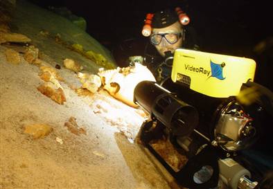
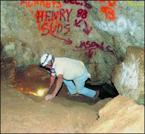
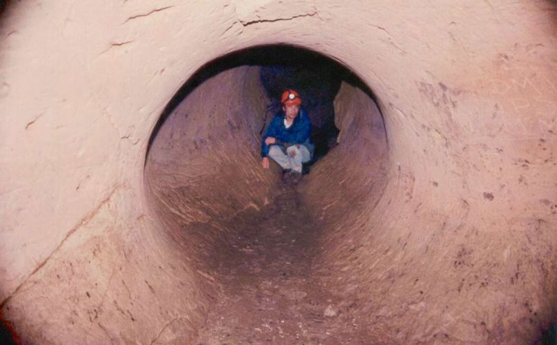
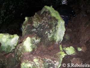
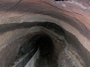
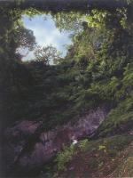
Un hábitat, el subterráneo, provoca en el hombre sensaciones encontradas de atracción hacía lo misterioso, por su inaccesibilidad; y de repulsa, miedo y claustrofobia, por su falta de luz. Lo suponemos deshabitado o poblado de monstruos y formas fantásticas. Extrapolamos nuestra experiencia a todo el mundo vivo: si para nosotros es un medio hostil al que es difícil acceder, para los seres inferiores todavía será más difícil colonizarlo y establecerse en él. Para formas de vida de medio milímetro, toda la red tridimensional de fisuras, grietas y conductos, de cualquier tamaño y de cualquier espesor, que conforman el medio subterráneo a lo largo y ancho del globo terráqueo, constituye un universo poco menos que infinito.
¿Cuántas formas de vida diferentes pueden vivir en este universo paralelo prácticamente inexplorado por el hombre? ¿Millones? Ya se conocen miles en el planeta, a pesar de la escasa atención que los científicos de todo el mundo, y de todas las épocas, han dedicado a su estudio (Encyclopaedia Biospeologica, Juberthie et Decu, Eds. 1994, 1998 y 2001, 3 tomos).

Podemos mencionar un ejemplo revelador. Un grupo de diminutos crustáceos, los batineláceos, parientes lejanos de las conocidas gambas, que sólo pueden vivir en agua dulce subterránea y cuyos tamaños varían entre 0,5 y 3 milímetros. Viven en todos los continentes (en los Polos no se han buscado). El primero de estos animales se descubrió hace relativamente poco, en 1882, en un pozo de abastecimiento de agua en Praga. Desde entonces se han descrito hasta 250 especies en todo el mundo. Un número bajo, pero alto si se considera que sólo unos siete taxónomos hemos dedicado nuestra vida profesional a su búsqueda, captura y estudio en lugares muy limitados de todo el planeta.

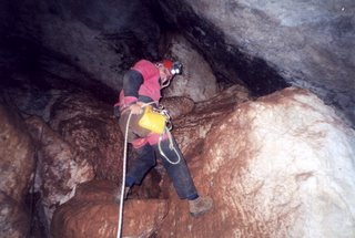
Reduzcamos la escala y situémonos en la península Ibérica. El primero de estos animales se encontró en Portugal en 1949. Llamó la atención de algunos estudiosos (Braga, Noodt, Delamare, Chappuis,...) que trabajaban con otros grupos de crustáceos. Estos investigadores decidieron hacer incursiones en las aguas subterráneas más accesibles (pozos artificiales y estanques y charcos en algunas cuevas horizontales de fácil acceso) y buscar estas curiosas criaturas traslúcidas, sin ojos, incapaces de nadar y llenas de estructuras misteriosas (sedas, uñas, dientes, dentículos...), cuya función sensorial puede ser intuida.

En 1978 ya se conocían 15 formas diferentes de este grupo, ligadas a seis autores europeos y a 14 lugares investigados. Apenas un diminuto muestrario comparado con los millones de lugares susceptibles de albergar fauna subterránea acuática en la península Ibérica y en las islas Baleares. En la actualidad, tras haber llevado a cabo muestreos en más de 1.000 sitios, he descubierto 35 nuevas especies que viven, exclusivamente, en estos lugares. Así, las 50 especies de batinelas en la península Ibérica constituyen una quinta parte de todas las que se conocen en el mundo. Algunas de ellas, aproximadamente una quincena, están pendientes de recibir nombre y de ser dadas a conocer a la comunidad científica.

Basta descender a otras dimensiones y ampliar las miras para entender que nuestro mundo tiene aún mucho que mostrarnos sobre nuestros orígenes y que deberíamos intensificar los esfuerzos y los medios para conocer, y poder conservar, los seres que nos rodean, antes de que nuestro progreso los acabe engullendo."
*Ana I. Camacho es investigadora del Departamento de Biodiversidad y Biología Evolutiva del Museo Nacional de Ciencias Naturales (CSIC).

14.3.06

Andalucia Explora


Hoy día sólo el mundo subterráneo y las profundidades del mar suponen un terreno todavía por explorar. La sensación de pasar por un lugar donde jamás nadie ha pisado antes sólo pertenece a esos privilegiados que sueñan con abarcar con la mirada lo desconocido. La necesidad de potenciar las exploraciones de los grupos andaluces es lo que lleva a la F.A.E. (Federacion Andaluza de Espeleologia) a buscar nuevos medios para compartir lo que siempre han hecho, explorar el mundo subterráneo: http://andaluciaexplora.blogspot.com/

13.3.06

Filmmaker’s Stone Age riddle


"A freelance documentary filmmaker believes he has stumbled upon a Neolithic archaeological site in a cave near Semporna, in the east coast of Sabah.
Kuala Lumpur-based Michael Chick, 36, found bits and pieces of skeleton and broken pottery dating back 2,000 to 3,000 years in the U-shaped cave on Friday. “I saw something that looked like teeth, so I dug a bit and found what looked like fossilised human bones,” he said.
“Based on the pottery and its crude design, I assume it to be from the Neolithic era,” he said without wanting to give the exact location of the cave.
Chick hopes to hand over his findings to Sabah Museum officials.
He explained that carbon dating had to be done by experts to determine the age of the bones and pottery that he had collected. Chick and his team collected about 25 bones and about 30 bits and pieces of pottery. Archaeologist would be able to determine if the site was a burial ground or even if it were a human skeleton, he said.
He said the people of Semporna told him that a Universiti Sains Malaysia archaeological team led by Datuk Zuraini Majid had been exploring the caves early this year.
In 1991, Zuraini and her team unearthed the Perak Man, believed to be about 10,000 years old, in Lunggong Valley.
According to natives, if the skeletal remains found by Chick were not from the Neolithic era, then it could be that of people buried in jars as that was the practice in the olden days.
They said even the Chinese community practised putting their ancestors' bones in jars kept on high grounds and in caves in Sabah."

Article & photo from: Thestar.com.my

Cave bears traded spaces with humans


A look at France's Chauvet Cave, famously adorned with millennia of cave paintings marked by long, deep bear scratches, suggests cave-sharing between people and bears goes back a long way.
Cave bears (Ursus spelaeus) died out in Europe within the last 15,000 years. But, "the question of a special relationship between cave bears and humans, such as hunting or worshipping, is still a debated issue," notes a study in the current Journal of Human Evolution. Basically the debate is over whether people revered the bears or ate them.
Led by Herve' Bocherens. of France's Universite Montpellier, the study team took a look at that special relationship by dating the cave bear bones littering the cave, located in southern France. Cave art there dates to 32,000 years ago, well before the bears became extinct. (...)
Full article: Usatoday.com

12.3.06

Galeria de água


Galeria de Cosme, Caldeira de Pedro Gil, Tenerife

Galeria artificial de conduçao de água. A sua construçao atravessou um cone de deposiçao de materiais piroclásticos de diferentes composiçoes, resultando nesta preciosa imagem.
A "exploraçao" de galerias artificiais em terrenos vulcânicos é uma actividade perigosa devido à elevada, e muitas vezes mortal, concentraçao de gases tóxicos.

Aberturas do Algar do Carvão

Algar do Carvão - Ilha Terceira

"A grande erupção, conhecida como “do Pico Alto”, que ocorreu a norte do aparelho vulcânico do Guilherme Moniz, já existente, derramou as suas lavas a grande distância. Mais tarde, uma nova erupção, desta vez basáltica, rasgou o solo e iniciou um processo que levaria à formação de um vulcão estromboliano – O Pico do Carvão. Numa primeira fase, ao forçar e tentar romper o derrame traquítico, já existente e que constituía uma barreira natural de consistência pouco “colaborante”, formou a zona da lagoa e as duas abóbadas sobre a mesma. Posteriormente, numa nova tentativa de evasão, as lavas basálticas, romperam mais ao lado a actual chaminé, saindo para o exterior. Na sua fase final o magma desceu para o interior das condutas mais profundas e da câmara magmática, dando origem, essa ausência quase instantânea do magma, à formação do Algar propriamente dito.Os derrames de lava muito efusiva, produziram rios de lava ácida muito fluidas que carbonizaram vegetação existente. A datação de um dos fósseis então formados, dá para o Algar do Carvão uma idade de 2148 ( + ou - 115 anos). " (Texto: Os Montanheiros)

Abertura ao Público:
Domingo, dia 16 de Abril de 2006


16 Abril a 31 Maio:
Todos os dias
Das 15:00 às 17:30

1 a 30 Junho:
Todos os dias
Das 14:30 às 17:45

1 Julho a 31 Agosto:
Todos os dias
Das 14:00 às 18:00

1 a 30 Setembro:
Todos os dias
Das 14:30 às 17:45

1 a 15 Outubro:
Todos os dias
Das 15:00 às 17:30

Entradas:
Grátis Sócios
€ 3,00 Adulto
€ 2,00 Cartão Jovem, Cartão 65

Mais informaçoes: Os Montanheiros

Cave reveals Indigenous ice age lifestyle secrets

A broader picture of Tasmanian Aboriginal life around the time of the last ice age is emerging through research on bone fragments from a south-west cave.
Researcher Dr Jillian Garvey says the animal bones from the floor of the Kutikina cave show people mostly hunted bennetts wallabies, then took the meaty hindquarters back to the cave, where the flesh was eaten and bones cracked to extract the nutritious marrow.
Also on the menu were wombat, grey kangaroo and the tasmanian emu, which became extinct after European settlement.
The cave, near the Franklin River in Tasmania's south-west, was used as a winter base by Aborigines.
Dr Garvey says the environment during the last glacial maximum was harsh and her research is illuminating how Tasmanian Aboriginals survived.
"We can now start to look at the overall landscape picture of the cave usage in that area because Kutikina is only one of several caves in the area and we already have an idea of the fauna in the other caves," he said.
"So what we want to do now is put together a perspective of how people were utilising these different caves over time, so we're going to start looking at teeth analysis to try and understand the season of hunting."
Dr Garvey spent months at the Tasmanian Museum and Art Gallery sifting through bone samples taken from the cave several years ago. (...)
Full article: Au.news.yahoo.com

Cave Explorer Movie


Hollywood is making a movie about the rescue attempt of a cave explorer from a South Central Kentucky Cave. The film is based off "Trapped", a book written by Robert Murray and Roger Brucker from Beavercreek, OH.

It's about the unsuccessful rescue attempt of Floyd Collins from Sand Cave near Mammoth Cave.

To write the book, Brucker sneaked into the sealed-off cave in 1977 and reconstructed the two week rescue attempt.Seventy-six year old Brucker has written four books on caves and is a co-founder of The Cave Research Foundation.The Paramount Pictures' film will be directed by and star Billy Bob Thorton.

Article from: Wbko.com

Related sites:

Terror in a cave set for silver screen

Floyd Collins Webpage

Showcaves.com FloydCollins

The Book, "Trapped! the Story of Floyd Collins: The Story of Floyd Collins", by Robert K. Murray, Roger W. Brucker

9.3.06

Fossil Chemistry


The most valuable fossils found in sediment cores are from tiny animals with a calcium carbonate shell, called foraminifera. One species of foraminifera lives in the icy waters of the Arctic above Iceland and near Antarctica. When McManus and other scientists began to uncover a large number of fossils of polar foraminifera in cores collected off the coast of Great Britain as part of an ongoing research project, they knew that the waters there had once been much colder. Once the fossils had been dated, they told scientists when the ocean had been icy cold. By finding cold-water foraminifera of the same age elsewhere in the oceans, scientists can construct maps showing where cold water existed at various points in the Earth’s history.

The microfossils themselves can speak volumes about the chemistry and temperature of the ocean. The calcium carbonate shells of foraminifera and coccoliths (their plant counterparts), and the silicon dioxide shells of radiolarians (animals) and diatoms (tiny plants) all contain oxygen. Oxygen in sea water comes in two important varieties for paleoclimate research: heavy and light. The ratio of these different types of oxygen in the shells can reveal how cold the ocean was and how much ice existed at the time the shell formed. In general, the shells contain more heavy oxygen when ocean waters are cold and ice covers the Earth.

Wind and Water Currents
A large deposit of microfossils of plants and animals can also tell scientists about ocean currents and wind patterns. Ocean plants and animals use the nutrients at the surface of the ocean, die, and then carry the nutrients with them as they sink to the sea floor. In some regions, strong ocean currents sweep nutrients up from the bottom to feed a thriving population. Called upwelling, the phenomenon drives plant and animal populations up until the nutrients are all used, and the microscopic plants and animals die. A small plant called a diatom takes particular advantage of upwelling. Ocean cores hint at patterns of upwelling when one contains a particularly thick layer of microfossils, especially diatoms, from the same time. Since upwelling currents are largely driven by the wind, these patterns also tell scientists something about wind and weather patterns.

Dust in ocean cores can reveal weather and current patterns. Today, great plumes of Saharan dust snake their way across the Atlantic to the American continents. Dust blows into the Pacific from Asia’s vast interior deserts. When the dust shows up in ocean cores, scientists can analyze its chemistry to determine where it came from. By charting the distribution of the dust, scientists can see where the winds were blowing and how strong they were. The dust also gives scientists a glimpse into how dry and dusty the climate may have been at a particular time.

Bits of continental dust can be swept into the ocean by rivers as well as the wind. The dust’s location on the ocean floor as well as the mineral content of the dust give scientists clues about where the dust came from and how it arrived at its final location on the ocean floor. For example, dust in the middle of the Pacific Ocean is more likely to have been carried on the wind than deposited by rivers.
Sediment made up of mineral grains from the continents can also tell about ocean currents. After the sediment is dumped in the ocean by the wind or rivers, it is swept on currents to its final resting place on the ocean floor. The distribution of the mineral grains can reveal how strong the currents were and where they flowed. Currents also carry icebergs from their point of origin toward the equator where the ice melts. Rocks and soil embedded in the icebergs sink to the ocean floor and later show up in ocean sediment cores. Their final location tells scientists where currents once flowed, and, indirectly, where water warm enough to melt the ice existed.

Text & Photo from: Earthobservatory.nasa.gov

8.3.06

New research shows bats have complex skills to deal with ’clutter’

A bat finds its way around with sound rather than sight. Using a sensory process called echolocation, the bat emits ultrasonic pulses that hit objects like leaves, trees, and insects, and bounce back to the bat to tell it what’s in the vicinity. When an echo returns from "clutter" at the same time a sound bounces back from an insect, the bat has a real challenge figuring out where the bug is.

In an article published in the open access journal PLoS Biology, University of Maryland psychology professor Cynthia Moss reports on new research that shows bats have methods for echolocating food in "clutter" that may be more complex than scientists have thought.

In its hunt for prey, a bat flies around at high speeds, emitting pulses of varying pitches and speeds. Using an array of high-speed infrared cameras and strategically placed microphones in the "Batlab," Moss’s team was able to match slowed video and audio recordings of the bat’s echolocation activity and corresponding movement as it pursued an insect tethered to a string. The insect could be out in the open, or nestled in among leaves.

"We have found that bats adjust the timing of their sounds when they encounter clutter, and they seem to ’strobe’ the world with sound," says Moss. As the bat gets closer to what could be an insect, it sends out an array of quick repetitive pulses, called sonar strobe groups. Finally, when it has locked onto the bug, right before scooping it up, the bat shoots a rapid fire series of sounds called the final buzz.

"In each case we found that the bats spent more time strobing when the insect was positioned near a plant, a strong indication that they used sonar strobe groups to try to distinguish the insect from the background clutter," Moss says. "They also varied the intervals between pulses in the strobe group, depending on the distance between the prey and clutter."

"Most importantly," says Moss, "the results of this study clearly show that bats control the timing of their calls to directly influence the patterns of echoes used for perception." This work nicely highlights a growing body of evidence from a variety of species, including humans, for the necessity of active participation in sensing the world.

Article from: Innovations-report.com

Patagonian cave paintings stun scientists

Chilean and French scientists announced they have discovered for the first time elaborate pre-Columbian cave paintings by indigenous Alacaluf people on an isolated island in Patagonia.
More than 40 stunning paintings were located inside the so-called Pacific Cave on Madre de Dios island, in Chile's far south, expedition head Bernard Tourte of France said.
The Alacaluf, a nomadic and seafaring people indigenous to the area, were not previously known to have produced such art.
"For years, people have insisted that this group did not engage in artistic expression, so now we are seeing that they were more advanced than had been believed," anthropologist Marcelo Aguilera said.
The paintings, in mostly black and ochre colours, have a range of subject matter and varied techniques, according to Mr Aguilera.
The two-month expedition, sponsored by the French and Chilean governments, cost $800,000.

Article from: Abc.net.au


Ao menos assim, ninguém se perde...

6º Mini-simpósio no Museu da Lourinhã

Arribas da Lourinhã podem ajudar a compreender o clima do Jurássico.


Nota de Divulgação:

O Museu da Lourinhã vai realizar um mini-simpósio sobre geologia do Jurássico e Cretácico. Este é o sexto mini-simpósio do Museu da Lourinhã e enquadra-se na parceria científica entre o Museu da Lourinhã e a Universidade Metodista do Sul do Texas, EUA e na estratégia de criação de uma forte rede de cooperação internacional que tem vindo a ser promovida por Octávio Mateus do Museu da Lourinhã. Nesse sentido, geólogos e paleontólogos desta reputada universidade norte-americana deslocam-se a Portugal para colaborar em estudos sobre o Jurássico Superior de Portugal. Um dos objectivos é fazer uma análise detalhada e sequencial dos isótopos de carbono e oxigénio das arribas da Lourinhã de forma a compreender o clima durante o Jurássico superior. A geologia e a fauna das camadas que contém dinossauros do Jurássico superior de Portugal são muito semelhantes à Formação de Morrison, nos Estados Unidos, que deu os fósseis de dinossauros famosos como o Stegosaurus, Diplodocus ou Allosaurus. O professor Louis Jacobs, autor dos livros "Quest for African Dinosaurs" e "Lone Star Dinosaurs", considera que a geologia das arribas da área da Lourinhã tem uma das melhores sequências para estudar o Jurássico e pode mesmo ajudar a compreender o clima no mundo de há 150 milhões de anos.


6º Mini-Simpósio no Museu da Lourinhã: Geologia

10 de Março de 2006 (Sexta-feira), 18:00
Museu da Lourinhã

Paleoclimate Information from Ancient Groundwater: Examples from the
Cretaceous of the North and South Poles
Kurt Ferguson (Southern Methodist University, USA)

Comments on the Geological Occurrence of Jurassic Dinosaurs in Africa
Louis L. Jacobs (Southern Methodist University, USA)

Paleosols of the Late Jurassic of Portugal
Scott Myers (Southern Methodist University, USA)

Terrestrial Proxies of Paleoclimate
Neil Tabor (Southern Methodist University, USA)

Dinosaurs in the Lusitanian Basin
Octávio Mateus
(Museu da Lourinhã & Universidade Nova de Lisboa)


Mais informações:
Octávio Mateus
Museu da Lourinhã
Rua João Luis de Moura, 2530-157 Lourinhã, PORTUGAL
Tel: [+351] 261 413 995 (Museu);
www.museulourinha.org
www.lusodinos.blogspot.com
www.dinodata.net/lusodinos

7.3.06

Rock of Ages - Abandoned Rock Quarry Images


Photographer Edward Burtynsky has a special series of pictures he’s taken of abandoned rock quarries in the United States.

The series is entitled Rock of Ages. There are some very dramatic and impressive pictures in the collection.

Cave photography

Getting Great Pictures in Nature’s Darkroom
by Dave Bunnell

Basic Principles of Cave Photography Equipment for cave photography http://www.goodearthgraphics.com/virtcave/cave_photography.pdf

Sub-continent's longest cave system discovered

"The longest cave system in the Indian subcontinent has been discovered in Meghalaya's Jaintia Hills district by an international team of speleologists.
The team found a cave system over 22.20 km long, which surpasses the previous known record of 21.55 km of another system existing in the same district.
''The linking of the Krem um im-Liat Prah cave system to Krem labbit (Khaidong) to create a single cave system of 22,202.65 m in length is the longest cave known to date in the Indian sub-continent,'' the team members told a press conference today.
The team comprising 17 members from the UK, two each from Switzerland and Denmark, one each from Austria and Ireland and five from India spent three and half weeks in the district focussing on the cave areas of Shnongrim Ridge near Nongkhlieh area.
This finding surpassed the previous record of the longest cave system in the sub-continent - the Kotsati Umlawam measuring 21.55 km, said B D Kharpran Dally, a reputed speleologist in Meghalaya, Between February 7 to March 1 the team explored 39 caves, mapped and photographed to discover 15,498 metres of new cave passage. Of the 39 caves mapped 36 were entirely new with only three being cave systems that were partially explored in previous years, he said.
Terence M Whitaker, a research biologist from the UK and a team member, said Jaintia Hills district has the highest concentration of caves in the sub-continent. Exploration of these would reveal new species of aqua animals."

Article from: Outlookindia.com

Equipa da GNR é a única a ter o curso de Espeleologia

"Oito horas. As portas do posto da GNR de Rio Maior abrem-se, mas no seu interior, no gabinete da Equipa de Protecção da Natureza e Ambiente em Zona Específica (EPNAZE), três homens preparam, há longos minutos, mais um dia de vigilância no Parque Natural das Serras de Aire e Candeeiros. São perto de 40 mil hectares, uma área imensa, onde os crimes ambientais se sucedem poluição provocada pelas pecuárias e pela indústria de curtumes, areeiros ilegais, pedreiras que não cumprem a legislação e caçadores fortuitos.Mas Rui Freire e Vasco Lopes têm outra mais-valia no currículo. São os únicos guardas no país com o curso de Espeleologia, o que lhes dá liberdade para descer às várias grutas existentes na serra, investigando crimes ambientais, fiscalizando os lençóis freáticos ou mesmo o desaparecimento de pessoas. Preparam a criação de uma equipa de resposta, caso seja necessário socorrer vítimas a muitos metros sob o solo, que possa englobar, para além de elementos da GNR, bombeiros e espeleólogos. Enquanto o terceiro elemento da equipa, Alberto Freitas, não se decide se se aventura ou não neste "novo mundo". (...)

"contra o crime na serra"

Espeleologia
Porque faltava à GNR a vertente do ordenamento do território cársico, dois guardas fizeram o curso. Este ano vai avançar a segunda fase da exploração, que os tornará autónomos no meio. SEPNAA EPNAZE integra o Serviço de Protecção da Natureza e do Ambiente (SEPNA), uma especialização da GNR, criada em Janeiro de 2001. Os incêndios florestais, os resíduos e a poluição, o controlo sanitário e protecção animal são algumas das áreas prioritárias. (...)"
Artigo Completo: JN.sapo.pt

Juegos Mundiales 2006 Sevilla


For the first time in the city's history, the city of Seville will host large-scale games where the sports will not be those included in the Olympic programme. In collaboration with the different Spanish Federations, Seville Town Hall has created the first World Games to be held in 2006.

Arizona Tries Tourism to Save "Living Cave"

"In 1974 cool, moist air billowed from a crack in Arizona's sunbaked desert and lured cave hunters Randy Tufts and Gary Tenen underground. There, glistening formations of rock hung from the ceiling like icicles and sprouted from the ground. The explorers were overwhelmed. They'd discovered a so-called living cave.
Tufts and Tenen were the first humans known to set foot in the Kartchner Caverns, which today are among the world's top show caves.

Kenneth Travous is the executive director of Arizona State Parks in Phoenix. He said the discovery of the caverns burdened Tufts and Tenen with an obligation to protect the underground labyrinth from ruin.
When Arizona State Parks staff people first saw the caves, "the same thing happened to us that happened to them," Travous said. "You look at it and you get overwhelmed with the responsibility of it."
The caverns are "living," a term used to describe active caves. "The cave formations still have water on them, they're still continuing to grow," said Rick Toomey, a staff scientist at the Kartchner Caverns in Benson.
Rainwater from the surface seeps through the ground, absorbing calcium carbonate along the way. Inside the cave, the mixture drips from the ceiling. As it hardens, it forms the icicle-like stalactites on the ceiling and sproutlike stalagmites on the floor. (...)"

Floyd Collins


Billy Bob Thorton começou a se preparar para produzir um filme baseado na vida de Floyd Collins, famoso explorador de cavernas do Kentucky.
A história se passa em 1925, ano da morte do explorador, e é baseada no livro Trapped!: The Story of Floyd Collins, e Robert Murray e Roger Brucker.
O papel principal ficará sob respnsabilidade do próprio Thornton. A personagem Floyd Collins foi o primeiro a explorar a Sand Cave, no famoso Mamooth Cave System, no Kentucky.
Durante a exploração, que teve início em 30 de janeiro de 1925, rochas caíram sobre seus pés e calcanhares e o explorador ficou preso. A operação de resgate durou 18 dias e Collin não suportou. Sua morte foi pronunciada em 16 de fevereiro do mesmo ano.
Aos 37 anos, Collin tentava encontrar uma nova entrada para Crystal Cave, que ficava sob a fazenda de seu pai.
Em 1999, Dorian Walker também dirigiu um filme sobre a história de Collins, cujo nome é The Floyd Collins Story.

Fonte: SBE Noticias nº7

SBE Noticias

Boletim electrónico da Sociedade Brasileira de Espeleologia nº7

1.3.06

GRYKA E MADHE

The exploration of one of the biggest cave systems in Balkan- “GRYKA E MADHE”-PEJE-KOSOVA

"At the border of Kosova, Montenegro and Albania there is a huge massif “Bjeshket e Nemuna” (Accursed Mountains) with area about 3500 km2. By the geological structure it is a part of the internal Dinarides, while this is not a continuous ridge, but a structure of huge plateaus (Brada, Maja e Rosit, Gjeravica, Guri I Kuq, and so on), locally with the relative altitude up to 2000m. Some big portion of the cover formation of this massif is built by limestone sequences (mainly of Triassic and Jurassic age) in the nape position, which are locally altered by the metamorphosis (penetration of younger volcanic rocks). The highest peak of these hostile mountains, intersected by steep valleys in Albania is Maja Jezerce (2694), and in the part of Kosova the highest peak is Gjeravica-2656. The plateaus are meadow in the upper positions, and some groups of peaks and ridges come out of them, locally with high-mountain holokarst of alpine type." (...)
Full article & Fotos: www.aragonit-speleo.org


Mammoth Cave getting new lights as part of upgrade

Mammoth Cave National Park's $6 million lighting system is on track to be finished before March 2007, along with a new safety system for visitors, park officials said.
More than 900 new lights will be in the cave, reducing the voltage from 7,200 to 480 volts and cutting down on unwanted, unnatural plant growth, said Steve Kovar, the park's chief of maintenance.
"That wavelength of light - 592 nanometers - doesn't support growth of algae," Kovar said.
Along with better lighting, phones are being put in for safety alerts, Kovar said. A button will light up on a control panel, alerting underground workers of tornado watches and inclement weather on the surface.
"Our infrastructure is old," Kovar said. "We've never had the ability to monitor what's going on down there - now we will." (...)

Full Article: Kentucky.com

The International Show Caves Association (I.S.C.A.)

"The International Show Caves Association (I.S.C.A.) was founded in November 1990 and set up its central office in Genga, Italy. This web site contains lists and contact information for each of the member show caves and organizations, listed by country (click on a country link above).Click on one of the flags at left to read about the objectives of the organization.The purpose of the Association is to guarantee, on the one hand, the respect and the safeguard of the subterranean environment and its natural wonders while on the other hand it aims at promoting the economic development of the caves by supplying to all its members (i.e. the show caves) the experiences and solutions gained on the subject of research and management activities carried out by the most advanced caves which can afford a larger expenses.After the first Consitutent Assembly held in Frasassi (Genga Ancona, Italy) in November 1989, important events have contributed to the development and consolidation of the association."

Oficial Site: http://www.i-s-c-a.com/

Baltic Speleological Congress 2007

Date: 13 – 15 August 2007

Location: Wisby Strand, Visby, Gotland, Sweden


Gotland is a karst island off the east coast of Sweden. Visby, the main city on Gotland, is an old, medieval Hansa city. Visby has also been chosen by UNESCO as a World Heritage Site. Detailed info on Gotland and Visby can be found here.
The congress venue will be Wisby Strand. Detailed info on eating facilities, meeting facilities, stand facilities etc can be found via the Partner links.
By choosing a location that has served as a social and cultural hot spot for centuries, we hope to bring together cavers from the countries surrounding the Baltic Sea and beyond.

The congress organisation will be a joint-venture one, consisting of delegates from the Swedish Speleological Federation, delegates from the other Baltic Sea speleological organisations/federations*, Inspiro Event (PCO) and Gotland Convention Bureau. This will guarantee a high-quality and caver-friendly event.

Oficial Site: Speleo.se


2006 NSS Convention


***Bellingham, Washington August 7-11, 2006 ***
Welcome
The 2006 convention will be hosted at beautiful Western Washington University. The university is located between Puget Sound and the Cascade Mountains, just outside of downtown Bellingham. Built with nature and beauty in mind this will be a stunning backdrop for the 2006 NSS Convention.
Situated between Seattle, Washington and Vancouver, British Columbia, the spectacular natural environment of this region stretches from the San Juan Islands to Mt. Baker. Bellingham area and community offers recreational experiences from the relaxing to the exhilarating.
Oficial Site: NSS2006.org